The Greater Köpenick Round Trip
On the situation of the Spree in Berlin
Before the description of the round trip begins, a few preliminary remarks on the water management situation of the Spree in Berlin. About 46 km long, the Spree flows from east to west through Berlin. The stretch from Dämeritzsee through Müggelsee to its mouth in Berlin-Köpenick is called the Müggelspree.
Note: The Spree is also called Müggelspree above Dämeritzsee, namely starting from Große Tränke (downstream of Fürstenwalde), where it branches off from the Oder–Spree Canal. However, this section of the Müggelspree is closed to motor-driven watercraft, therefore not a waterway and consequently not kilometred in Fig. 2.
In Köpenick the Dahme also flows in (see Fig. 2). The Spree section downstream of the confluence of Müggelspree and Dahme is called Oberspree; after the branch-off of the Britz connecting canal the water is called Treptower Spree, and from the Landwehr Canal it is Berliner Spree. In central Berlin the two arms of the Spree form the Spree Island. Shortly after the Weidendammer Bridge the original course of the Panke flows into the Spree from the north. After the branch at Humboldthafen to the Berlin–Spandau Shipping Canal the Spree winds through the Großer Tiergarten, is called Untere Spree in Charlottenburg and finally flows into the Havel in Berlin-Spandau. From its sources in Saxony to its mouth the Spree is 382 km long. The Upper Havel is significantly shorter at 165 km from its source to the Spree confluence. From 1882 to 1885 the Spree in Berlin was developed as a navigation route. It was straightened and in the city centre the banks were reinforced with walls.
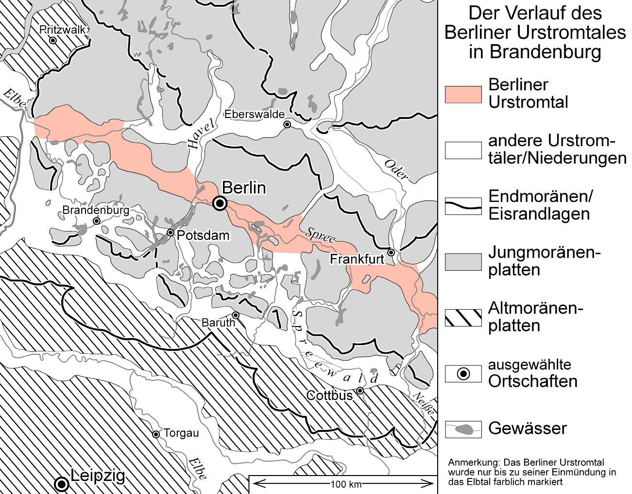
The numerous lakes in the south of Berlin originate from the Weichsel glaciation and lie in the Berlin urstromtal. In the north of Berlin there are only a few smaller lakes, since the Barnim Plateau (end moraine arc) is located there. The vast retention areas of the Berlin lakes cause floods in the upper reaches of the Spree to remain almost unnoticed in Berlin. The difference in water level between mean water level and highest flood is only a few centimetres.
Despite the abundance of water in the lakes, the Spree can suffer significant freshwater shortage especially in the summer months. At the last large gauging station before the Spree reaches Berlin – this is the Leibsch gauge in the Unterspreewald – a discharge of 0 m³ is regularly recorded in dry summers. Between the existing weirs the Spree then becomes a largely standing water body.
When, after a prolonged dry period, a heavy rain event occurs and the combined sewer overflows activate, this leads to significant problems with water quality in parts of Berlin's water bodies. The discharge of mixed wastewater requiring treatment consumes the remaining dissolved oxygen still present in the waters, and fish kills can occur. In the past the Teltow Canal was particularly affected by this.
For the drainage of the brown coal open-cast mines, considerable quantities of groundwater were pumped off during GDR times and discharged into the Spree. The water from the 2.500 square kilometre Lausitz mining district (13 billion cubic metres) flowed for decades mostly into the Spree, although a large part of it originated in the catchment area of the Schwarze Elster. Since the end of the brown coal mining, the groundwater level has been rising again and until a new equilibrium is established, the Spree lacks water.
The groundwater deficit resulting from mining-related groundwater drawdowns in Lusatia amounts to 7 billion m³ (of which 2.5 billion m³ for the open-cast mine residual pits to be filled and 4.5 billion m³ to refill the resulting groundwater cones). With this volume of water, a large city like Berlin with 4 million inhabitants, at a consumption of 120 L/(cap * d), could be supplied for more than 40 years!
(Luckner, L.: Lausitz: Rehabilitation of the water balance of a post-mining landscape Part 1: The solution to the water quantity problem wwt Wasserwirtschaft Wassertechnik Issue 3/2006, pp. 33-36)
Since 1997 Berlin and Brandenburg have been constructing reservoir lakes that guarantee a minimum inflow and thereby are intended to support the function of the reservoirs built during GDR times in the Spree catchment. These are the dams Spremberg (main Spree), Bautzen (main Spree) and Quitzdorf (Schwarzer Schöps), which were at the time built primarily to secure the cooling water supply for the lignite power stations. Because of its very low gradient of about 1 ‰ the Spree flows very slowly, on average about 50 cm per second. Between Cottbus and Berlin-Köpenick it is only 17 cm per second and over the 46 km through Berlin the mean flow velocity is only 9 cm/s.
In extreme dry periods it even happens that the Spree flows backwards. Then water from the Havel penetrates into the Spree. This phenomenon was most recently observed in 2018 and 2019. In GDR times the problem of reverse flow also occurred several times in the Müggelspree. This was caused by the inflows of two inner-city tributaries – the Wuhle and the Erpe. Via the Wuhle the effluent of the now decommissioned Falkenberg sewage treatment plant and via the Erpe the effluent of the Münchehofe sewage treatment plant were discharged into the Spree. After a prolonged drought the discharge of treated wastewater from these plants exceeded the supply of natural Spree water from the upper reaches. It was therefore possible that treated wastewater flowed into the Müggelsee and thus directly advanced into the intake area of the Friedrichshagen waterworks, which always caused considerable alarm. Because of the aforementioned discharges several river bathing facilities along the Spree also had to be closed during GDR times.
In the course of the expansion and upgrading of the sewage treatment plants and the cessation of industrial discharges, the situation has meanwhile clearly improved again. After the Berlin East Harbour was also closed down, a new use of the Spree banks developed in this area. Examples that have become known are the beach bars at the East Side Gallery and the floating bathing ship at the Treptowers. Increasingly, considerations are being made to make the Spree usable for local recreation throughout the city. The biggest problem here is that combined sewer systems predominate in Berlin's inner-city area and in the densely built-up urban area there is no space for stormwater retention basins. Therefore, during rainfall events polluted combined wastewater must currently be discharged directly into the Spree via the relief structures. This happens up to 30 times a year. However, there are also considerations under way on how this can be changed.
A solution, for example, is to place floating stormwater storage units on the Spree in front of the outfall of a stormwater relief. These would, when the relief is activated, take up the water requiring treatment, store it temporarily and pump it back into the combined wastewater system after the rainfall has subsided so that it can be conveyed to the next sewage treatment plant. Such stormwater storages in the form of large pontoons could at the same time be used as bathing platforms and restaurants (project “Spree2011”).
So much for some preliminary remarks on the water management situation.
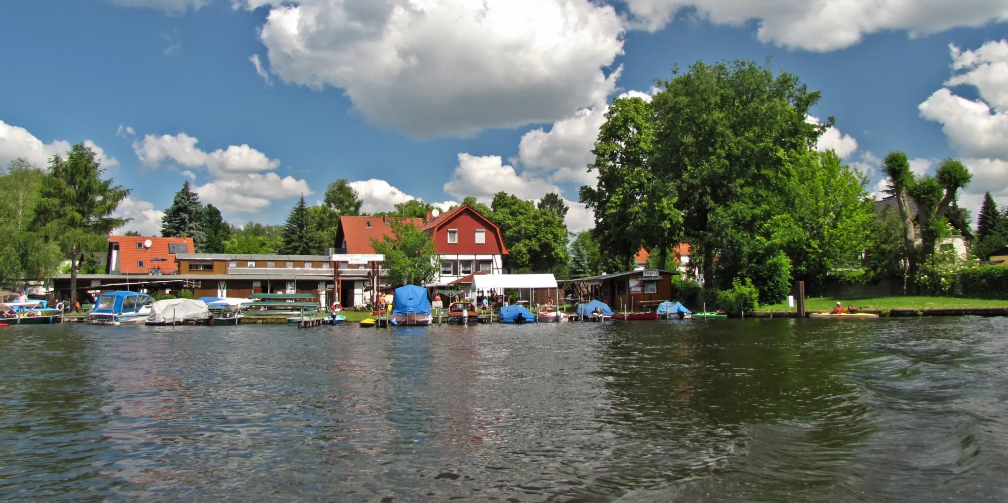
(Photo: Sterger, 28.5.2012)
Now we begin the Greater Köpenick Round Trip. Our circuit runs clockwise; we start from the Sturzbecher boatyard on the Alte Spree (see Fig. 4) and the first water body we pass is the Gosener Canal.